Professional Tools
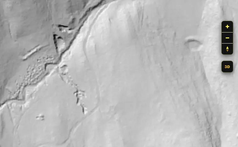
Bare-Earth LiDAR FREE/PRO
See through the trees. Our high-resolution LiDAR scans digitally strip away vegetation and buildings to reveal the bare ground underneath. Instantly spot historical shafts, adits, trenches, and tailing piles that have been hidden for 170 years. Note:** Free Version is lower resolution - Upgrade to Pro for better vision.**
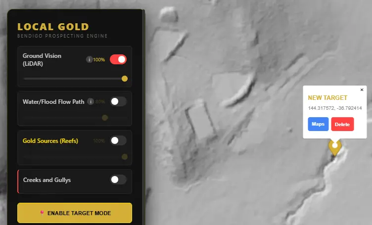
Target Mode FREE
See something interesting and need an exact location? Hit the Target Mode button and select a point, with the option to open it in maps or delete the marker.
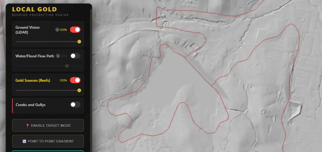
Historic Quartz Reefs Free
Overlay the historic Bendigo quartz reef and fault line mapping data directly onto the modern LiDAR. See exactly where the deep-lead source gold originated so you can track how it shed down the adjacent gullies over thousands of years.
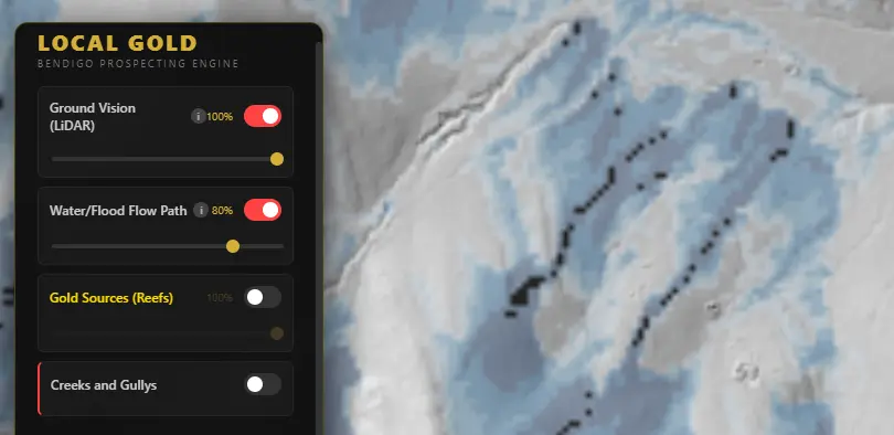
Water Flood Paths PRO
A scientific flow accumulation simulation that calculates exactly where water funnels across the bare-earth terrain. Because gold is exceptionally heavy, it follows these exact paths during extreme floods, settling predictably in the main drainage lines.
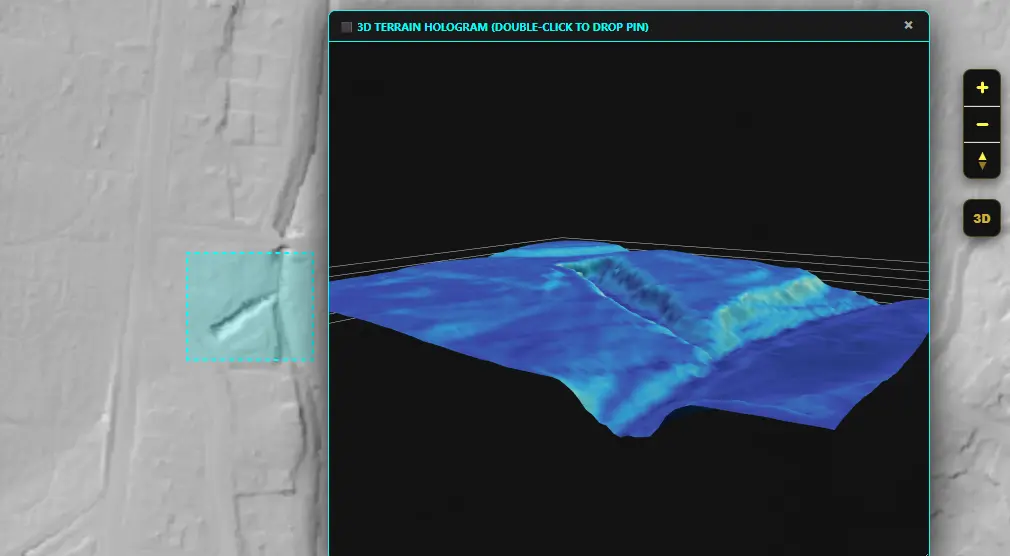
3D Terrain Scanner PRO
Draw a boundary over any area to instantly generate a super-HD, fully rotatable 3D topographic mesh. Analyze slope angles, run artificial lighting models for terrain contrast, and predict where heavy placer gold has dropped out of suspension.
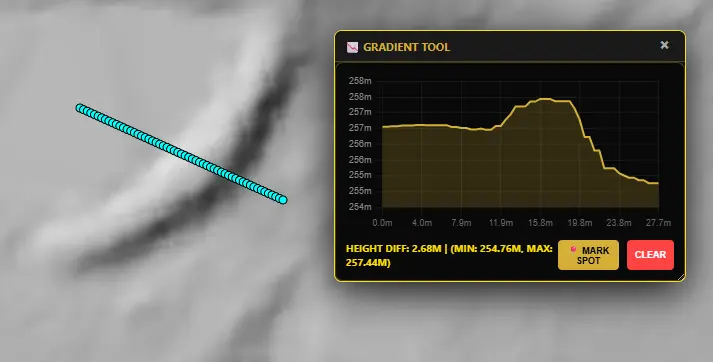
Gradient Profiler PRO
Draw a point-to-point line across any gully or ridge to generate an instant cross-sectional elevation graph. This allows you to find natural traps, drop-offs, and steep complexity gradients where high volumes of heavy materials collect.